Hello, welcome to UNITECHROAD co., LTD
Language:


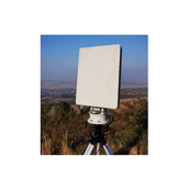


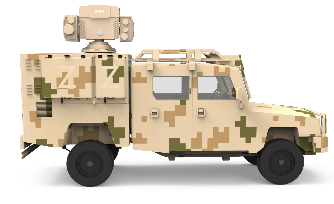
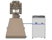
The RC-T10 low-altitude surveillance radar is primarily used for low-altitude and ground surveillance. This radar employs digital beamforming technology, resulting in a low equivalent isotropically radiated power (EIRP) and a high data search rate. The radar utilizes adaptive clutter suppression technology and track-before-detect technology for dense target detection. It has an extremely low false alarm rate due to clutter and can automatically track and build routes for over 150 targets, providing high-precision position information.
⚫ Three-coordinate system, azimuth coverage range of 360°, elevation coverage range of 30°
⚫ Capable of indicating the coordinates and speed information of moving targets within the radar scanning range
⚫ Capable of automatically indicating the movement trajectory of targets
⚫ Equipped with clutter filtering functionality, effectively ignoring ground clutter, water clutter, and weather clutter when establishing tracks
Operating frequency: 10.4~10.6GHz
Frequency hopping count: 4
Elevation coverage range (elevation field of view): -5°~30°
Azimuth coverage range (horizontal direction): 360°
Detection height: ≥800 meters
Detection distance: ≥5 km (DJI Phantom 4 drone), ≥8 km (personnel), ≥10 km (vehicles)
Angle measurement accuracy: Azimuth: ≤0.4° (RMS), Elevation: ≤0.4° (RMS)
Distance measurement accuracy: ≤5m (RMS)
Blind zone: ≤25m
Antenna rotation speed: 2 seconds/rotation (180°/s)
Simultaneous target tracking capacity: ≥150 targets
Detection radial speed range: 1~100m/s
Excellent clutter suppression capability, common clutter does not cause false alarms
Environmental adaptability: -40~+55°C
Operating humidity: ≠60%
Protection level: IP65
Weight: ≤20 kg
Power: ≤200W
Main unit dimensions (excluding servo): 580*500*75mm
Wind resistance: Can operate normally in winds below level 6
 Wechat scan code follow us

24-hour hotline+8615210163317

Phone+8615210163317
UNITECHROAD co. LTD ADD:Room 910, 9th Floor, No. 65 Fuxing Road, Haidian District, Beijing. ICP:ICPBEI********No. Sitemap